Counting groupers, a key fish species in the Mediterranean
How does mathematics help scuba divers count groupers? Do currents and ocean warming play a role in these results? An article by Sébastien Simao, associate professor of mathematics at Monte-Cristo High School in Allauch, South of France, and member of the Vulgarisation des Maths group at the Institute for Research in Science Education (IRES).

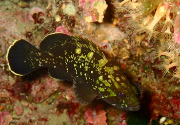
Every year for the past 22 years, my diving club, in partnership with the French Federation of Underwater Sports and Studies (FFESSM) and the Calanques National Park, has organized the “Des Espèces Qui Comptent” ("The species that matter") initiative. This participatory event is the largest of its kind in France. It brings together around 150 divers and helps to survey vulnerable Mediterranean species across all of Marseille’s dive sites, particularly the grouper. This fish is very placid and therefore vulnerable to spearfishing. It sits at the top of the food chain and is therefore very interesting to study.
In this article, we will explain how this survey, conducted by divers from Marseille, helps biologists estimate the grouper population. We will also discuss how, using the data collected, we plan to apply more advanced mathematical methods to determine the spatial distribution of groupers based on the divers’ underwater trajectories.
To ensure a high-quality count, the divers are divided into groups: they survey areas at slightly different depths along the rocky walls, or move a few meters apart on plateaus. The count is limited to depths of less than 30 meters, as it is estimated that beyond this depth, these species are scarce. Each dive team records their observations on forms, noting the depth, time, size of the fish observed, and their direction of movement.
The results are then grouped by site and analyzed to eliminate duplicates. Here are the results for groupers in the Calanques National Park:
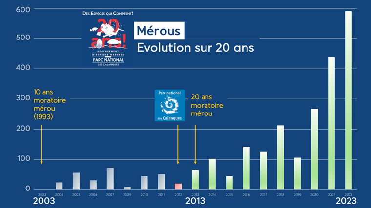
This diagram clearly shows the impact of the creation of the Calanques National Park in 2012, as well as the effect of the fishing moratorium: the number of groupers observed is generally on the rise throughout the park. However, these data remain incomplete and imprecise. Thus, the “gaps” present for certain years are attributable to the Covid pandemic or to unfavorable weather conditions preventing exploration of certain sites. Furthermore, it is not clear whether these observations can be extrapolated to the entire grouper population in the park.
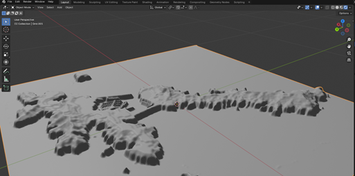
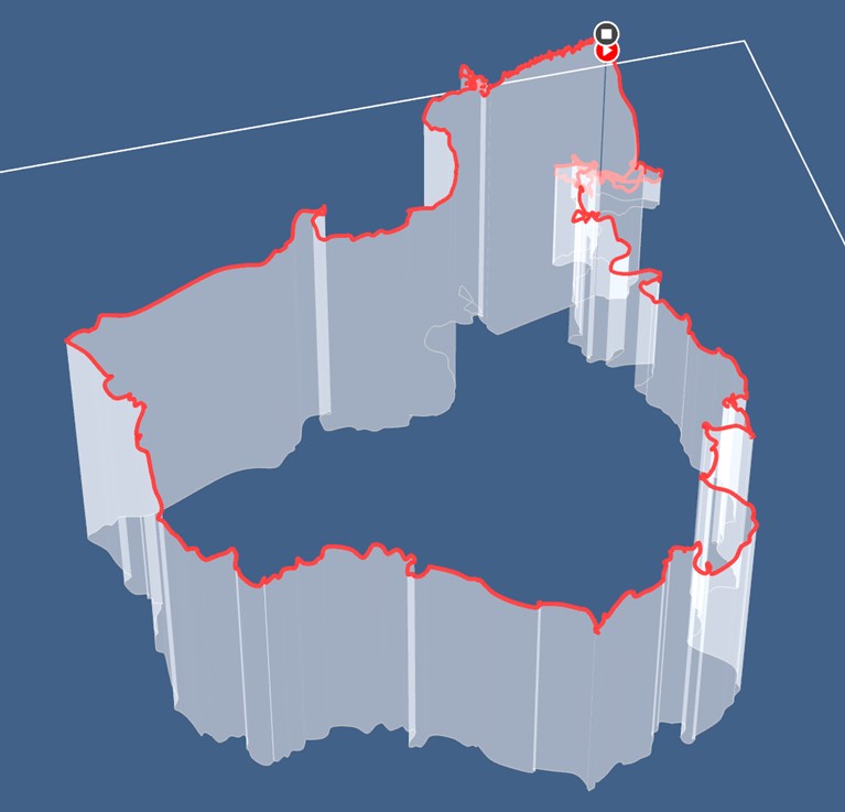
But our participatory project is not limited to simply counting fish; it also involves precisely tracking their location. Even though the GPS signal does not work underwater, since we know the surface trajectories of the dives requested by the organizing team, the dive time, and the duration and depth of the observations, we can theoretically determine the precise positions of the groupers observed at each site and plot them on 3D maps of the various Marseille dive sites, such as the one presented here for Frioul Island:
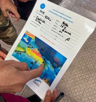
Unfortunately, underwater currents can be strong, particularly at the site of the Impérial du Milieu, a rocky islet near Riou Island, whose underwater walls are teeming with biodiversity.
The map of planned surface routes, such as the one shown here, is therefore no longer sufficient, as divers must seek shelter from the current, thereby skewing the count and positions.
Manufacturers of dive watches—which are now essentially computers—have taken on this challenge: the latest models can display the 3D path taken by divers upon surfacing. But how is this possible? The watches track depth, as well as orientation using a compass, and are equipped with an accelerometer. To reconstruct the 3D trajectory of divers, they use techniques for the numerical solution of differential equations. The simplest method, Euler’s method, involves approximating the trajectory using the velocity vector, which provides the direction over small time intervals.
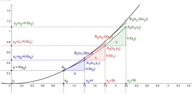
However, errors in trajectory estimates accumulate over time... So yes, by increasing the frequency of measurements over shorter time intervals, we reduce these errors. But we are still limited by the device’s electronic constraints.
Once again, mathematics comes to the rescue: once back on the surface, we can retrieve the diver’s exit GPS coordinates and refine the approximate trajectory. Furthermore, data stored online by divers whose trajectories are relatively smooth—that is, without sudden, sharp movements toward the surface—allow us, with a bit of machine learning, to refine the trajectories.
Using these curves, we can therefore accurately position the groupers on 3D maps created from bathymetric data, and obtain fairly precise snapshots of observations over the years.
This study raises many questions: do currents and ocean warming play a role in these results? We know that groupers are born in warmer waters; we are currently witnessing a shift in their birthplace. What is the impact of the growing grouper population on other species? How do corbs—another species studied and counted because they are protected by the same law as groupers—move in schools?
Thanks to the support of volunteer divers, biologists were able to collect a wealth of data on the evolution of protected species in the Calanques National Park. Mathematics plays a key role in making the most of this collected data: we hope that this type of participatory event will become widespread across several protected natural areas in the Mediterranean, thereby fostering a better understanding of underwater ecological issues.